Import spatial data into BricsCAD
Imports spatial data, into new or existing BricsCAD drawings, as BricsCAD objects and Extended Entity Data (EED).
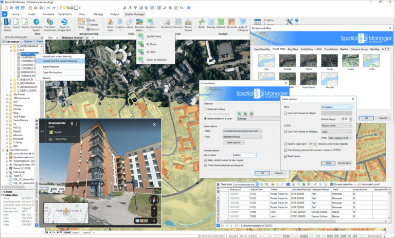
Spatial Manager for BricsCAD is a powerful BricsCAD plug-in developed for users who need to import, export, transform and manage spatial data in a simple, fast, and inexpensive way.
Imports spatial data, into new or existing BricsCAD drawings, as BricsCAD objects and Extended Entity Data (EED).
Export objects from the drawing to spatial files or databases, and saves their Extended Entity Data (EED) as alphanumeric data tables
Calculate geometric transformations of the objects in the import and export processes
Choose from among a lot of dynamic Backgrounds Maps from providers such as Google Maps, OpenStreetMap, Bing, MapBox, Ordnance Survey, etc., or configure your own maps from TMS, WMS or WMTS servers
Export all or part of the objects in the visible Layers of the drawing and their data to a KML or KMZ file
Visualize objects coloring them depending on their field values
Manage the alphanumeric data attached to the objects, design and edit the structure which will be used to store the data
The Data Grid palette allows you to view, edit, etc. the objects data in any table in the drawing. You can also select objects from the Data Grid, export the data from the tables and more
New V8 Calculate simple or complex expressions using operators and functions that can be applied to field values in a table and/or to constant values
Perform spatial analysis operations over the objects in the drawing generating new objects from such analysis
Location and geo-coding tools help to add reference elements and enhanced data to existing objects
Google Street View dynamic image browser on any geo-referenced drawing or map
Label data values from tables attached to the objects as Texts
Create Terrains and other related objects (3D Points, Contours, etc.) from 3D data or from Elevation services
Save Tasks to replay import processes (including all process parameters) so many times as desired
Available in English, German, Spanish, French, Russian and Portuguese
Pay once, no periodic fees
One-Time (Not recurring)
Standalone or Network
One-Time (Not recurring)
Standalone or Network
One-Time (Not recurring)
Standalone or Network